Home >  Eclipses >  Solar Eclipses > Total Solar Eclipse of 2016 March 9 Drapeau LangueFrançais
Indonesia Flag

 Total Solar Eclipse of 2016 March 9
 on Ternate and Tidore in Indonesia

 Ternate  Tidore

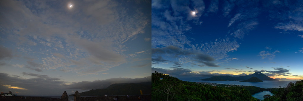
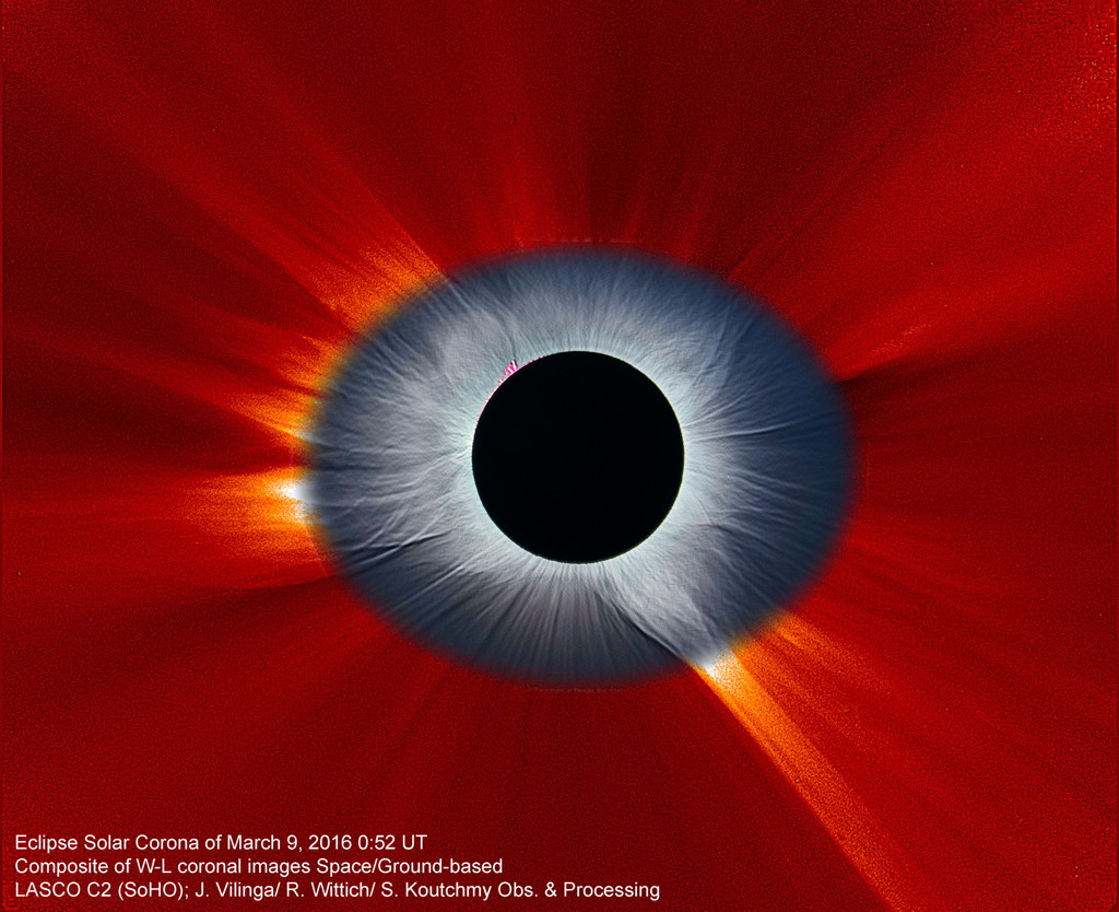
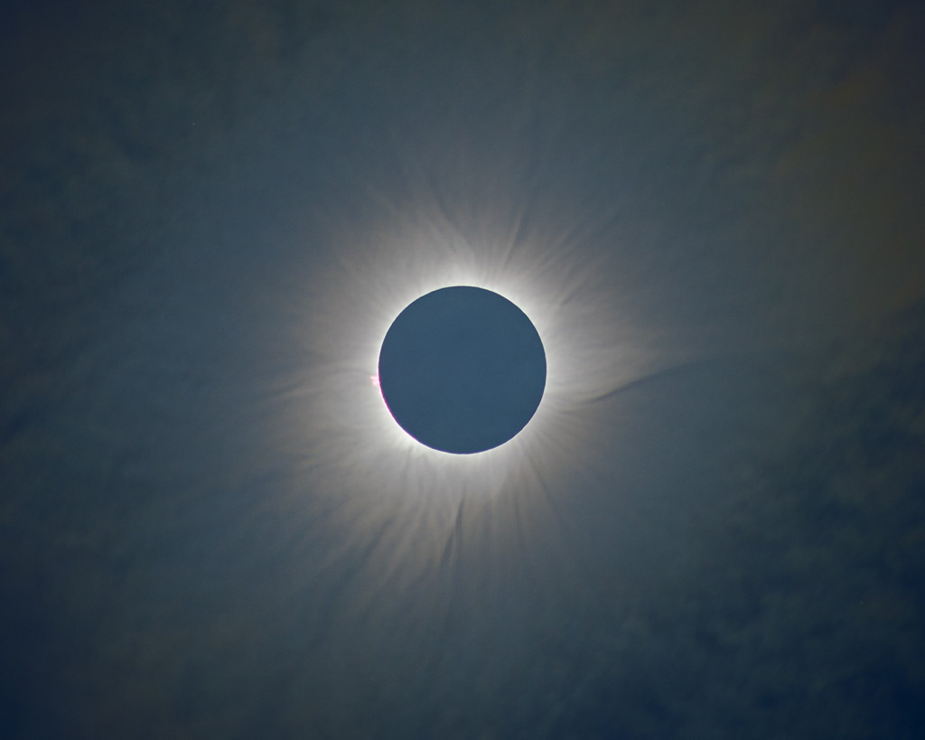
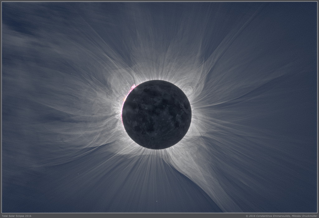
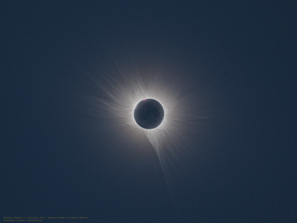
The point of greatest eclipse (totality phase during 4 min 9 sec) was located in the middle of the Pacific Ocean east of Indonesia where about 10 million people lived inside the totality path. To observe the 2016 March 8-9 total solar eclipse, I proposed tours only in eastern Indonesia, in the Northern Maluku, where the ground weather prospects were the best and the duration the longest. However the local infrastructure was fairly limited. The Woleai atoll, belonging to Micronesia, was offering the longest land-based duration very close to its maximum but its airstrip was out of order so the logistics would have been far too complex even though going there on a boat was a possibility. There were numerous viewing locations along the path, however paying close attention to the weather patterns and local terrain topography was mandatory unless you were on a cruise ship in the Pacific Ocean where the sky was usually clearer. Moreover the 2015-2016 El Niño episode did somewhat improve the weather prospects in Indonesia.
Thanks to the Ministry of Tourism and Creative Economy and the various local authorities for their help.

You can use this solar eclipse calculator to compute the local circumstances of the eclipse, and the solar eclipse timer notifies the beginning of the various events. A time exposure calculator is there to help you choose your camera settings.


Click on thumbnails for a larger version

Page "Introduction" |  Page "Scouting" |  This is page "Eclipse" |  Page "Google Map" |  Page "Weather" |  Page "Gerhana Matahari"
Viewing Sites —>  Halmahera Indonesia Flag |  Ternate Indonesia Flag |  Woleai Micronesia Flag |  Eclipse Flights Indonesia Flag USA Flag |  Cruise Ships Indonesia Flag Micronesia Flag
Ternate, the second largest island of the North Maluku archipelago, is usually the entry point for accessing the North Maluku islands because of its larger airport but also as being the ancient capital with its long history and notably the spice trade. The island of Ternate was off the centerline, but still offered 2 minutes and 45 seconds of totality. Moreover the other islands in the direction of the centerline (Tidore, Mare, Moti and Makian) were easily accessible from Ternate which means reaching 3 minutes and 14 seconds of totality was achievable.
Taking a picture from the summit of the Gamalama volcano during totality provided a magnificent view of the eclipse and its surrounding landscape.

The two pictures below provide a clear view of the clouds patterns over Ternate and the island to the south as well: Tidore, Mare, Moti and Makian. The weather conditions weren’t that great a few hours before the eclipse, the sky was cloudy and it rained.
Total Solar Eclipse 2016 Ternate Tidore Mare Moti Makian Pulau Molucca North Maluku Utara Indonesia
On the left a picture taken by Jay Pasachoff from Benteng Kalamata and on the right a picture by Babak Tafreshi from an overlook at Danau Ngade

During totality the team of the Astrophysics Institute of Paris (IAP) led by Serge Koutchmy was able to collect some valuable scientific data despite the thin layer of scattered clouds.
Total Solar Eclipse 2016 Ternate C2 Baily Bead Prominence Jaime Vilinga Molucca North Maluku Utara Indonesia
Prominence and Baily beads at second contact by Jaime Vilinga

Ternate being sufficiently far away from the centerline seeing the lower layers of the chromosphere was possible. The outline of the entrance slit is shown by the two vertical red lines crossing the lunar limb profile where the second contact took place. The spectrum obtained (low First Ionisation Potential or FIP emission lines, chromospheric/TR emission lines and the green FeXIV line at 5302.85 Å) is upside down compared to the drawing such that the bright spectrum of the second contact is at the top; at the bottom you’ll find the part of the corona with the coronal continuum and the FeXIV line. Do note, on the top part of the spectrum, the resolution near the coronal line with the F-line and its blue wing seen in emission!
Total Solar Eclipse 2016 Ternate Spectrum Low FIP Emission Line Green FeXIV Continuum Corona Cyril Bazin Jaime Vilinga Molucca North Maluku Utara Indonesia
From data of Cyril Bazin and Jaime Vilinga

Similar "bluish halo" effect on Pulau Plun.
Total Solar Eclipse 2016 Pulau Plun C2 Prominence Bluish halo Peter Aniol Molucca North Maluku Utara Indonesia
Prominence and "bluish halo" at second contact from Pulau Plun by Peter Aniol

Total Solar Eclipse 2016 Composite SoHO LASCO C2 Ternate Molucca North Maluku Utara Indonesia
Composite image of views from space with SoHO (LASCO C2) and ground in Ternate


On March 9, 2016, Panasonic delivered a live broadcast of the solar eclipse from Ternate, using solar power
(Panasonic ECLIPSE LIVE by SOLAR POWER 2016)

Total Solar Eclipse 2016 Ternate Bela International Solar Corona Composite Robert Slobins Molucca North Maluku Utara Indonesia
Composite of the solar corona by Robert Slobins (through a thin layer of clouds)

The sky over the southern part of Tidore island was clearer than over Ternate, the next nearest island, where there was a thin layer of clouds. On the first picture of the solar corona, one can see the trace of thin clouds in the upper left corner.
Total Solar Eclipse 2016 Tidore Flash Spectrum Emission Line Green FeXIV Constantinos Emmanouilidis Molucca North Maluku Utara Indonesia
Flash spectrum by Constantinos Emmanouilidis from southern Tidore

Total Solar Eclipse 2016 Tidore Middle Corona Constantinos Emmanouilidis Molucca North Maluku Utara Indonesia
Photos, processed by Miloslav Druckmüller, of the solar corona by Constantinos Emmanouilidis from southern Tidore

Total Solar Eclipse 2016 Tidore Outer Solar Corona Michael Semenov Molucca North Maluku Utara Indonesia
Photos taken on Tidore by the members of the Intellect Tour russian expedition

Viewing Sites —>  Halmahera Indonesia Flag |  Ternate Indonesia Flag |  Woleai Micronesia Flag |  Eclipse Flights Indonesia Flag USA Flag |  Cruise Ships Indonesia Flag Micronesia Flag
Page "Introduction" |  Page "Scouting" |  This is page "Eclipse" |  Page "Google Map" |  Page "Weather" |  Page "Gerhana Matahari"

Last page update on March 20, 2016.
Site Map — Legal Mentions


Page Rank
Google


Guest Book Guest Book
Xavier M. Jubier