Home >  Eclipses >  Solar Eclipses > Total Solar Eclipse of 2017 August 21 Drapeau LangueFrançais
United States America Flag 

Total Solar Eclipse of 2017 August 21
in the United States of America or airborne

#eclipse2017, #tse2017, #2017eclipse
 Great American Eclipse Logo

The point of greatest eclipse (totality phase during 2 min 40 sec) lies in Kentucky. However the point of longest duration with 2 min 41.6 sec is located in southern Illinois. Although there is not any material difference between points of greatest eclipse, maximum eclipse, and corrected longest eclipse, local boosterism will likely be intense with claims and counter-claims about the best location. More importantly, people have to understand and adopt a strategy for eclipse success factoring weather, mobility, etc. These points of longest eclipse are almost meaningless in that context, nevertheless I can envision people crowding on a farm at the cloudy point of longest duration refusing to budge even if clear skies are reachable. The eclipse whose path crosses 14 states —not just the 12 or 13 only that many wrongly advertize—, one of them, Montana, very slightly in a mountainous area so that nobody staying in this state is likely to witness the unimaginable beauty of totality, will likely create a new "Generation Eclipse" much like the March 1970 did.
Oregon Flag Idaho Flag Montana Flag Wyoming Flag Nebraska Flag Kansas Flag Iowa Flag Missouri Flag Illinois Flag Kentucky Flag Tennessee Flag Georgia Flag North Carolina Flag South Carolina Flag
Seeing the eclipse from the ground in its surrounding natural environment is the way to go and get the full experience, particularly if it’s from your home country. However for those willing to have a slightly different experience, I’ll propose one eclipse flight over the Northern Pacific Ocean (one special flight in a brand new Falcon 5X with a zenithal window was another possibility, but the certification of the aircraft has been delayed). It’s unlikely that I will offer any ground tour for a group as organizing one on an individual basis is straightforward. Moreover I’ll also have to take care of some complex scientific measurements with huge constraints.

More comprehensive information and useful eclipse goodies can be found on the Great American Eclipse website maintained by my friend Michael Zeiler. The maps have been created using the data computed by my Solar Eclipse Maestro software. Please take also a moment to read those comprehensive instructions on how to observe the eclipse safely.

You can use this solar eclipse calculator to compute the local circumstances of the eclipse, and the solar eclipse timer notifies the beginning of the various events. A time exposure calculator is there to help you choose your camera settings.


Click on thumbnails for a larger version

 
Page "Introduction" |  Page "Where to Go" |  Page "Unequivocal Totality" |  This is page "Eclipse" |  Page "Google Map" |  Page "Weather" |  Page "Totality Duration" |  Page "Fact-checking"
Viewing Sites —>  Oregon |  Idaho |  Wyoming |  Nebraska |  Illinois |  Other States |  Eclipse Flights
An eclipse flight is an experience of its own kind. When it happens into the stratosphere aboard a private jet, as on 2015 March 20th, then it’s even more special.
Total Solar Eclipse 2015 Stratospheric Flight Totality Dassault Falcon 7X Cockpit Moon Umbra Wing View

The following video can show you what to expect from your special flight experience that I could organize off the West Coast to have a solar elevation compatible with an observation through the aircraft’s windows.


Video by Mike Kentrianakis on 2016 March 8th AS870 flight (details in the Alaska Airlines blog)

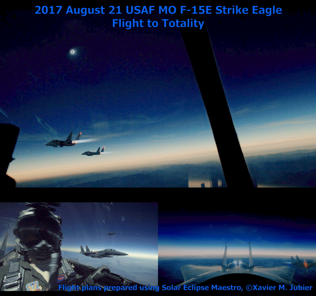
One of the multiple eclipse flights I planned for the US Air Force and Navy.

Total Solar Eclipse 2017 Flight Totality USAF F-15E Strike Eagle Fighter Jet

Multiple eclipse flights will occur on 2017 August 21st, one of them having zenithal windows for scientific purposes will increase the maximum duration by 60%. Other than specially modified aircrafts, only one private jet model can achieve such an observation thanks to its unique zenithal window: the brand new Dassault Falcon 5X. Due to the high solar elevation when the Moon’s umbral shadow crosses the continental USA, regular commercial jets will need to intercept the path either at sea off the West Coast or else Northeast of the French Antilles.


Simulation of an eclipse flight at maximum totality duration (created with my Solar Eclipse Maestro software)
Use of this simulation is strictly forbidden without my written approval. All commercial uses are subject to a fee for every planned flight.

Viewing Sites —>  Oregon |  Idaho |  Wyoming |  Nebraska |  Illinois |  Other States |  Eclipse Flights
Page "Introduction" |  Page "Where to Go" |  Page "Unequivocal Totality" |  This is page "Eclipse" |  Page "Google Map" |  Page "Weather" |  Page "Totality Duration" |  Page "Fact-checking"

Last page update on July 20, 2018.
Site Map — Legal Mentions


Page Rank
Google


Guest Book Guest Book
Xavier M. Jubier