|
Total Solar Eclipse of 2019 July 2
in Chile, Argentina, Pitcairn Islands (Oeno) or aboard a Cruise Ship
|
|
|
The point of greatest eclipse (totality phase during 4 min 33 sec) lies in the Southern Pacific Ocean. Before reaching Chile, there is no landmass inside its totality path, but a small uninhabited atoll called Oeno (Pitcairn Islands). Going once again to Chile is rather tempting because of the good weather prospects, despite the limited mobility, and the observatories inside the path of totality; neverthless a remote observation from the remote Oeno island is even more enticing with a super-yacht. Or else Argentina near the Andes which provides both good weather prospects and mobility.
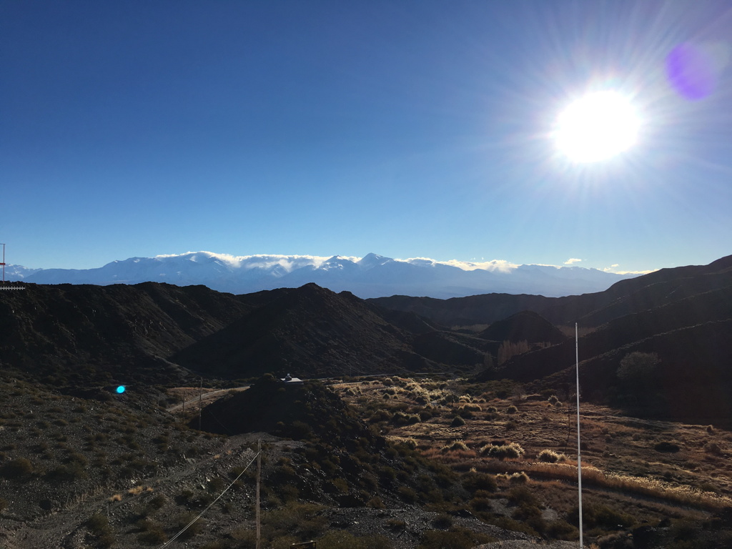
Cruise ships, such as the Paul Gauguin, will be inside the eclipse path to maximize the duration and clear sky odds, but for those who prefer to be on firm ground Chile or Argentina provide the best weather prospects, albeit wintry, at the expense of a duration cut in half and with a low black Sun (more aesthetic especially with the snow-capped Andean peaks in the foreground).
In December 2020 another total solar eclipse will cross the same two countries and cruises will be possible in both the Southern Pacific and Southern Atlantic oceans. During a period of 10 years, 2010 to 2020, both Chile and Argentina will experience three total solar eclipses plus one annular.
You can use this solar eclipse calculator to compute the local circumstances of the eclipse, and the solar eclipse timer notifies the beginning of the various events. A time exposure calculator is there to help you choose your camera settings.
Click on thumbnails for a larger version
|
|
|
|
|
We will focus on Chile and Argentina. The analysis of the mean cloud cover at the time of the eclipse shows that there are two favorable ground-based areas in South America: inland in Chile, where you can find the international astronomical observatories, as well as the highlands just behind the Andes in Argentina. Several scouting trips were executed both in Chile and Argentina to confirm on the ground the validity of the statistical data.
Chile:
In Chile it turns out that special attention must be paid to the marine layer which is very often present in the morning along the coast around La Serena. Usually this marine layer burns out before noon, yet it could reform, at least partially, during the eclipse due to the temperature drop. It should be noted that the locations at an altitude higher than about 500 meters (1,500 feet) are generally above this marine layer. That’s why it’s recommended not to observe from the coastal zone, but rather move a couple tens of kilometers inland where the elevation is sufficient and also where it’s drier. With totality taking place about one hour before sunset it’s all the more important to optimize the seeing. The few photos below illustrate my words.
|

Marine layer from La Serena in the morning in July (Chile)
|

Marine layer from La Serena around noon in July (Chile)
|

Marine layer from La Serena at time of totality in July (Chile)
|

Beautiful day in La Serena 20 minutes after totality in July (Chile)
|

Elevation gain (500 meters or 1,500 feet) to break through the marine layer in July (Chile)
|

Clear sky (1,000 meters or 3,000 feet) above the marine layer in July (Chile)
|
|
Then to be able to observe the eclipse it’s mandatory to find a place where the horizon is unobstructed enough and where the view is not blocked by hills. There are two possibilities, the first being the Panamerican road (Ruta 5) towards La Higuera which allows a sufficient altitude gain, or the road leading to the El Elqui valley (Ruta 41) and in particular Vicuņa (after Vicuņa it’s almost impossible to find an unobstructed view to observe totality). A bit of climbing may be necessary to find a place with a 360-degree panoramic view.
Many people will probably be traveling around Vicuņa and La Higuera as both areas are easy to reach.
360-degree panoramic view around Mamalluca in July 2018 before totality time
180-degree panoramic view from La Higuera in July before totality time
360-degree panoramic view from the El Pangue observatory in July before totality time
180-degree panoramic view from the Collowara observatory in July before totality time
|
|
Observing from a summit is of course preferable but more complicated, moreover it will be necessary to return at night. However it can also allow a better observation of the southern starry sky after the eclipse. On the first panorama we can see a thin marine layer that would likely have made eclipse viewing difficult at best from La Serena.
360-degree panoramic view from a summit in the El Elqui valley in July 2018 shortly after totality time
360-degree panoramic view from a summit near the central line in July 2018 before totality time
|
|
Those having an entrance ticket for the ESO La Silla Observatory will have a nice view of the eclipse but a shorter totality. It should be pointed out that the site of the Giant Magellan Telescope is located just on the northern edge of the eclipse path and that making measurements of the true solar radius is a great opportunity. As for the Cerro Tololo Inter-American Observatory it’s closed to the public for the eclipse.
360-degree panoramic view from the ESO La Silla Observatory in July 2018 before totality time
360-degree panoramic view from the Giant Magellan Telescope grounds in July 2018 shortly after totality time

Sunset from the 4-m Victor Blanco telescope at the Cerro Tololo Inter-American Observatory (Chile)
|
|
As for driving do pay attention to the smallest details on the road, especially on dirt roads. This Chilean driver went off the tar road right in front of me, the guardrail barely preventing the worst possible outcome. It is also necessary to look after your tires even when they are brand new, so do make sure you know how to change a wheel and have all the equipment! The "Ruta de las Estrellas" of the Antakari track is well suited to find an eclipse viewing location.

Tar road accident for a local driver (Chile)

Here is the result after driving at high speed on dirt roads (Chile)

Road to the stars, Antakari track (Chile)

Road to the stars, Gabriela Mistral track (Chile)
|
|
In winter the border checkpoint with Argentina is closed, it usually opens around mid-December and closes in May; the altitude of the Paso de Agua Negra is 4,780 meters (15,700 feet) and the tunnel under the mountain will not be open before many years. In case of bad weather do not expect to cross the border and go to Argentina. Moreover even during the summer it takes a lot of time. The border crossing is possible further south between Mendoza and Santiago de Chile, but this would be a very long detour and the weather can be capricious, so clearly not an option for the eclipse.

Juntas del Toro border checkpoint to the Agua Negra pass (Chile)

Paso de Agua Negra border between Chile and Argentina at an elevation of 4,780 meters or 15,700 feet (Chile-Argentina)

Tunnel project under the Agua Negra pass (Argentina)

Guardia Vieja border checkpoint (customs are 50 kilometers before at Las Flores) to the Agua Negra pass (Argentina)

Road to the border with Chile (Argentina)

On the way to Chile through the Paso Cristo Redentor late June 2018 (Argentina)
|
Argentina:
The starting point in Argentina will often be either San Juan or Mendoza. In San Juan the Museum of Natural Sciences lies just on the eclipse path southern boundary using true photospheric solar radius. The Bella Vista valley offers the best prospects of clear skies in Argentina, the only downside being a few clouds over the Andes for which it’s possible to limit the impact on the eclipse by gaining elevation. Usually the Andean peaks are snowier towards the south of the Bella Vista valley, near the El Leoncito Park, and most of the snowstorms occur later into the season.

Museum of Natural Sciences in San Juan on the southern limit (Argentina)

View from San Juan at totality time in late June 2018 (Argentina)

View from the El Leoncito Observatory (just outside of the eclipse path) at totality time in late June 2018 (Argentina)
Morning 160-degree panoramic view from the El Leoncito Observatory late June 2018
180-degree panoramic view from a Bella Vista overlook late June 2018 well before totality time
|
|
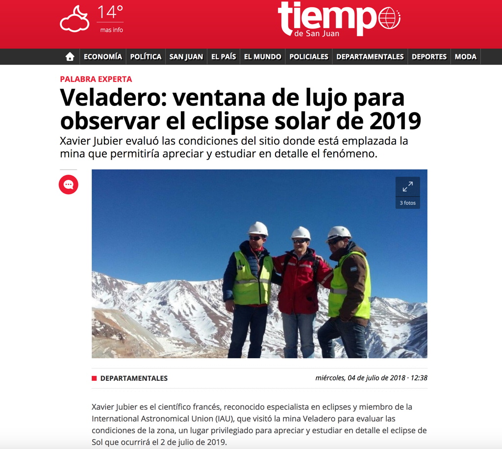
The Veladero gold mine is located on the northern limit just outside of the eclipse path, so it’s possible to make measurements of the solar diameter. The mine infrastructure is remarkable given the very high elevation, from 3,800 to 4,800 meters (12,500 to 15,800 feet), and its remoteness (seven hours from San Juan, most of it on dirt roads). My visit there made the front pages (article in the Tiempo San Juan), indeed getting access to this gold mine is exceptional. The mine was also the gateway to an ascent of Cerro Las Tórtolas, a peak higher than 6,100 meters (20,000 feet) located on the border with Chile and near the centerline. To observe the eclipse from this summit would be quite an achievement and the view from the summit during totality truly exceptional and unique during the winter.
180-degree panoramic view from the Veladero gold mine at 4,400 meters (14,500 feet) late June 2018 well before totality time


Cerro Las Tórtolas while going to the Veladero gold mine, view from the east (Argentina)

View towards northeast from the Cerro Las Tórtolas summit (Argentina-Chile)
|
|
|
|
|
|
|


