Total Solar Eclipse of 1925 January 24
in Northeastern USA or Ontario in Canada
On 1925 January 24, New York City got a peek at a total solar eclipse that enabled accurate measurements of the position of the southern limit of the Moon’s umbra. Such observations were already done during the hybrid solar eclipse on 1912 April 17 near Paris in France.
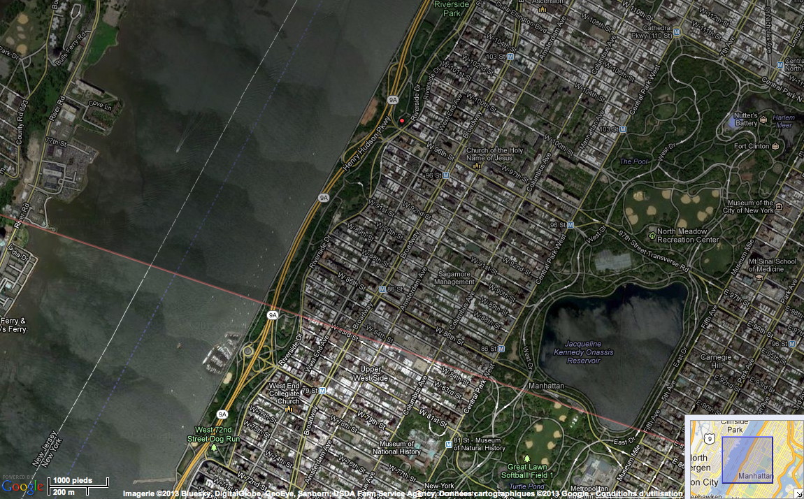
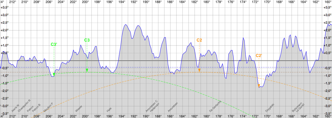
On the above eclipse map the southern limit is plotted using a smooth lunar limb profile, i.e. the real lunar limb profile isn’t taken into account, and a reduced mean lunar radius used is 1736.646 kilometers (k = 0.2722810) to better approximate the low lunar valleys. The observations have shown that the real southern limit was a bit to the north at the intersection of Riverside Dr and W96th St, that is about 800 meters north. The difference can be explained by the real lunar limb profile, see figure below, has there are lunar valleys lower then the reduced mean radius near the second and third contact positions.
Lunar limb profile at second and third contacts from the Riverside Dr and W96th St intersection at the southern limit over New York City
A complete high-resolution profile is available: 14400 by 400 pixels PNG image file (576KB)
(profile done using my Solar Eclipse Maestro software)
As one can see when using the real lunar limb profile, the position of second and third contacts is slightly shifted from C2 and C3 to C2' and C3' and the Sun’s photosphere is still visible, Baily’s beads, when using the reduced mean lunar radius of 1736.646 kilometers (k = 0.2722810) represented by the brown dotted line.
Baily’s beads from second to third contact from the Riverside Dr and W96th St intersection at the southern limit over New York City
(done using my Solar Eclipse Maestro software)
Lunar limb over a lunar topographic map from the Riverside Dr and W96th St intersection at the southern limit in New York City
(done using my Solar Eclipse Maestro software)