|
This new project is now being carried out and a scouting trip will take place in August 2006.
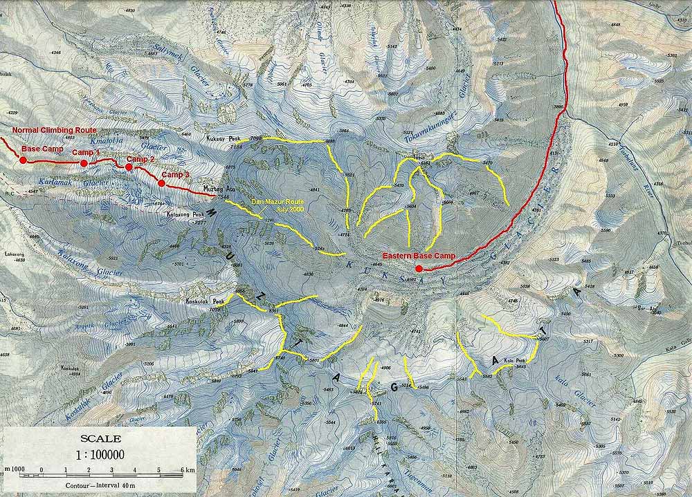
The main goal is to reach in three weeks the summit of Muztagh Ata at 7,546 meters (24,757 ft) on the normal route from the west. This project is linked to the groundwork for the solar eclipse trips of 2008 February 7 on the Vinson summit in Antarctica and 2008 August 1st in the Chinese Gobi desert.
So sponsors are most welcomed. Thank you all in advance for your support and help.
The Muztagh Ata lies on the "Karakoram Highway", a piste that offers a precarious connection between Pakistan and western China. The nearest location of any importance is Kashgar (this is the name in the local Uygur language, the Chinese say Kashi), an oasis town between the high mountain range of the Pamirs and the Taklamakan desert (Taklamakan means "who goes into it does not come out of it any more"). Kashgar once used to be a part of the Silk Road, the route of the traders that connected the orient with the occident from the middle ages on. The Venetian explorer Marco Polo passed by Kashgar on his fabled journey to China. It is part of the Xinjian province, which was an independent state for a long time, but was annected by China very much in the same way as Tibet. From Kashgar it takes you a day’s ride to the Karakul lake, where you get your first sight of Muztagh Ata. The meaning of Muztagh Ata is "Father of all Icepeaks". However the story goes that the explorer who mapped the area for the first time asked a boy, what the name of the mountain was and the boy answered, "Muztagh, ata", meaning "Icepeak, father" (father being used out of respect for the elderly stranger).
Muztagh Ata is quite impressive. Standing all alone and not being part of chain of peaks and being much farther north than the Himalayas give it the reputation of being a cold mountain. The problems lie in coping with the high altitude, the cold and the weather. However, the ascent poses no major technical problems. To climb the mountain, you are obliged to obtain a climbing permit, pay a fee and use some services of the China Xinjiang Mountaineering Association (CXMA).
This page will be updated as needed.
Click on thumbnails for a larger version
|
 August 2007 Muztagh Ata ascent in China
;)
;)
;)
;)
;)
;)
;)